Alpine crossing Tegernsee - Sterzing

Our easiest crossing of the Alps from Tegernsee to Sterzing.
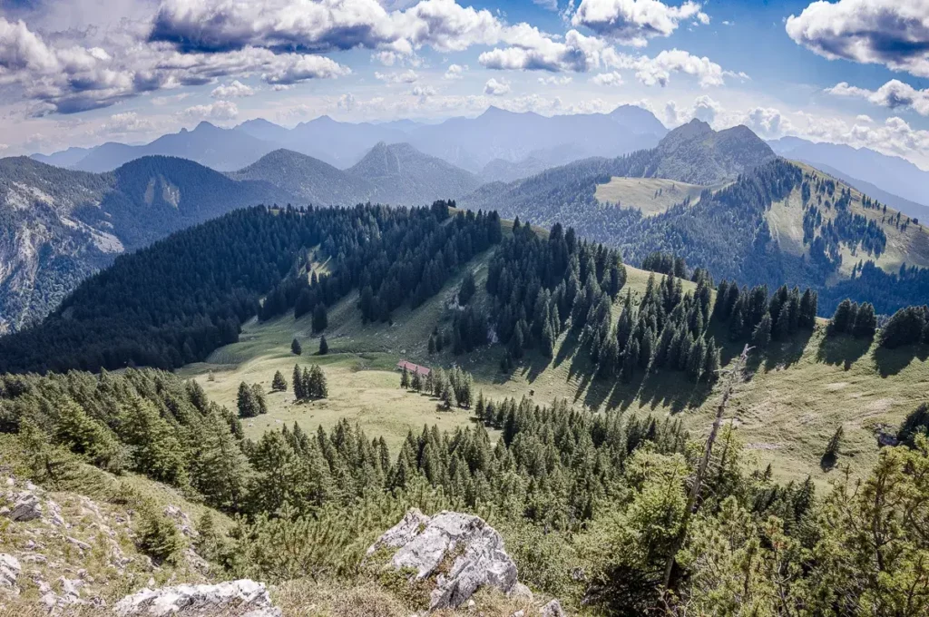
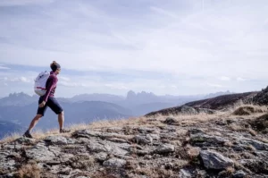
Once across the Alps on foot - an adventure that is absolutely worthwhile and feasible for everyone. Only with light luggage, the hike from Tegernsee via Achensee and Zillertal to Sterzing is the perfect introduction to the world of long-distance hiking. Every day new paths, views, landscapes and unforgettable impressions await you. The tour starts at the picturesque Tegernsee, leads without any difficulties over the Tyrolean border into the Rofan mountains and further into the Zillertal. Here, glaciated three-thousand-meter peaks dominate the scenery and you may hardly guess the easy transition at Schlegeis.
The grand finale takes place in South Tyrol with a wonderful ending hiking trail to Sterzing.
Program and schedule
- Mountain guide:in with the appropriate qualifications
- 5 x overnight stays including half board in selected hotels/inns
- Daily luggage transport
- If necessary boat trip at the Tegernsee
- Public transport according to program
- Cab / bus transfer to Tegernsee
- Free participation in the online training: Alpine crossing preparation (1 h)
Additional costs
- Snacks, drinks
- Arrival, possibly parking fee
Day 1: Meeting point at 10:30 am at Lake Tegernsee. The crossing of the Alps begins with the beautiful Tegernsee High Trail. Depending on your mood, we either take the boat for a short distance or continue straight on to Rottach-Egern. Accompanied by the ringing of cowbells and with plenty of time on our hands, we can already celebrate the first mountain hut stop of the coming week. Later, we board the bus that takes us across the border to Austria to our hotel in Achenkirch. Ascent 230 m / Descent 240 m / Walking time 4 - 5 h
2nd day: We start again with a view of the lake. We stroll along the Achensee with easy ups and downs and great views. We cross waterfalls roaring down from the steep cliffs, sheltered under roofs. The unique Gaisalm, only accessible on foot or by boat, is beautifully situated on the shores of Lake Achensee. The route continues past inviting bathing spots. The last section runs parallel to the historic cog railroad. Our destination is Maurach at the foot of the Rofan mountains. Overnight stay in an inn. Ascent 250 m / descent 200 m / walking time 4 h
Day 3: Refreshed and refreshed, we ride the first section down into the Inn Valley to Jenbach and on to Fügen. We quickly reach our starting point in the Tuxer Voralpen via the Spieljochbahn. The view down into the Inntal valley and of the Karwendel and Rofan mountain ranges is magnificent. A leisurely path takes us to the Alpengasthof Loas, where the famous Loasschnitzel is already waiting for us. We continue slightly uphill and downhill to Hochfügen, our destination for today. Overnight stay in the hotel. Ascent 400 m / descent 780 m / walking time 4 h
Day 4: To warm up today, the route is initially flat on the valley path as far as an alpine village typical of the Tux Alps, the Pfundsalm Niederleger. We climb steadily uphill over wide alpine pastures, pass old Swiss stone pine stands and soon reach the crossing into the next valley, the Sidanjoch. For ambitious hikers, we can "take in" the summit of the Kraxentrager (2,452 m) before descending towards the Rastkogelhütte. We continue to Melchboden on the Zillertal High Alpine Road, from where the bus takes us to our destination for today's stage in Mayrhofen. Overnight stay in the hotel. Ascent 900 m / descent 500 m / walking time 4 - 5 h
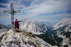
Day 5: Today we are going high up. We will cross the main Alpine ridge. The bus takes us up to the Schlegeis reservoir. We start our hike in the face of the famous Zillertal three-thousand-metre peaks Großer Möseler and Olperer. At the Pfitscherjoch (2,246 m) we cross the border into Italy. We now like to take a break at the Pfitscherjoch Haus, which is just a stone's throw away. We descend over gentle alpine pastures and extensive forests into the pristine Pfitschtal valley. The bus then takes us quickly to our accommodation in the Pfitschtal valley. Overnight stay in the inn. Ascent 500 m / descent 800 m / walking time 5 - 6 h
Day 6: We have almost made it. There aren't many more meters of altitude to cover today, but there is certainly some distance. A slightly elevated path leads us past old farmsteads slowly but surely towards our destination for the week. We can review this wonderful week once again before turning into the historic old town of Sterzing. In the market street, we quickly enjoy our well-earned cappuccino or Aperol Spritz before taking the shuttle back to Lake Tegernsee. Ascent 150 m / descent 600 m / walking time 5 - 6 h / return transfer approx. 2.5 h
Note on program changes:
All courses and guided tours are conscientiously organized and carried out in accordance with the safety standards of the Vivalpin Mountain and Ski School with qualified specialists (e.g. mountain and ski guides, mountain hiking guides, etc.). The provisional tour program may be adjusted for safety-related reasons, such as bad weather, dangerous conditions, unforeseen natural events or inadequate conditions of the participants. The final program will be decided by the guide on site.
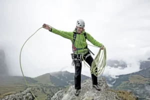
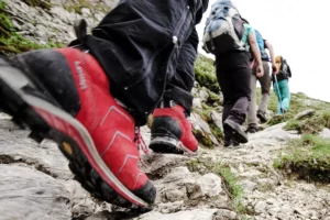
On the daily stages you can expect up to 900 m and 3 h in ascent and up to 800 m in descent. Prerequisite for the alpine crossing Tegernsee-Sterzing is a Stamina for hikes of up to 6 hours (pure walking time) with light luggage. The route is technically easy, with easy (blue) mountain paths to walk. With mountain guide:in the route is manageable for novices with the appropriate condition. Good preparation is half the battle for a multi-day hike: Get used to your mountain boots and to carrying a backpack. The best way to practice this is on hikes with comparable altitude differences. For your specific preparation, we recommend our intensive training in surefootedness and head for heights.

"Although this long-distance hike is considered technically easy, you should prepare well for it. Taking part in our online training with an expert is a great help. I also recommend that you pay particular attention to your choice of shoes. They should be comfortable and provide good support and, above all, have been extensively "broken in" by you. Because nothing is worse than getting blisters on a multi-day hike."
Cat Juhran
Mountain hiking guide
Member of the VIVALPIN Competence Team


Similar tours

Online training: Crossing the Alps

If you are planning to cross the Alps, there is a lot to consider. You should be able to correctly assess the requirements and difficulties, be familiar with objective and subjective dangers and be in control of your equipment.you will learn everything you need to know about preparation, packing your rucksack correctly, food, the special "hut life" from an experienced mountain professional...

Palaronda Trek

Cimo della Pala, Rifugio Rosetta, Passo Pradiadali, the names melt in the mouth. And indeed, the Pala Dolomites are something for alpine connoisseurs. For ski tourers, freeriders, climbers and, in particular, mountaineers and hikers. Because although the summit panorama is characterized by steep pinnacles and towers, mountain forests and plateaus are hidden in between...
Private mountain guide:in
Want a dream tour? We will be happy to organize an optimally qualified guide for you and your friends, family or company. Over 80 mountain guides are looking forward to your dream tour with you. They have turned their hobby into a profession and will accompany you with great commitment after meticulous preparation. There are virtually no limits: From...

Ammergau alpine crossing
The Bavarian fairytale king Ludwig II not only left his descendants magnificent castles, but also many a royal riding and hunting trail that was created especially for the eccentric monarch in the Bavarian Alps. This wonderful pleasure hike follows parts of these historic paths, as well as the most beautiful sections of the "Maximiliansweg", which was only opened at the beginning of the 1990s...
Karwendel High Altitude Trail

Karwendel - that is the epitome of untouched nature and rugged peaks, of austere beauty and wild solitude. However, the Karwendel Höhenweg cleverly finds the weak points between the inaccessible mountain ranges and is good and enjoyable for sure-footed and experienced hikers accompanied by a mountain guide.
Intensive training in surefootedness and head for heights

Surefootedness is one of the elementary skills for all mountaineers, hikers and climbers. Let a mountain professional show you important tips, tricks and exercises so that you can be more experienced and effective in the mountains in the future.
Dolomites Via Bellissima, South Tyrol
Which is the most beautiful Dolomite crossing? We asked a local who should know. Florian Harrasser comes from Bruneck, he has been Simon Gietl's rope partner for many years and is a passionate mountain hiking guide. The tour he has planned for us is not included in any hiking guide and is an absolute highlight. Because it connects the most beautiful spots in the Dolomites...

Alta Via No. 1 Dolomites High Trail
Enjoy the unique landscape on one of the most beautiful, technically easy alpine traverses on the Alta Via No. 1 Dolomites High Trail. Wonderful resting places, deep blue lakes and cozy huts with the best Italian cuisine make the Alta Via No. 1 a truly unique tour.

Alpine crossing Garmisch - Merano
On the crossing of the Alps from the Zugspitze to Merano you start at the highest point of Germany and have from here the route to the south in the best view. On often lonely paths and climbs you get to know the Alps from their best sides.

Alpine crossing Merano - Lake Garda
The Alpine crossing from Merano to Lake Garda is more than an extension of the classic E5. With VIVALPIN you hike in small groups of 6-8 participants, up to 7 hours per day on technically easy paths and climbs. You will enjoy a perfect organization with the best bases and all necessary transfers.