Mont Blanc with preparation

The ascent of the highest mountain in the Alps
Climbing the highest mountain in the Alps at 4,807 m is not only a special experience, but also a particular challenge for any ambitious mountaineer. It requires a good level of fitness, mastery of the crampon technique and perfect tactics in order to be well acclimatized and take advantage of a good weather window for the summit day. The conditions on the three normal routes have changed considerably in recent years, so that the route via the Grand Couloir and the Gouter hut currently appears to be the best.
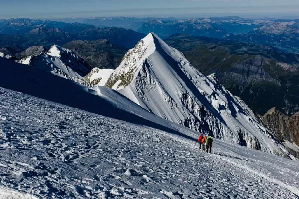
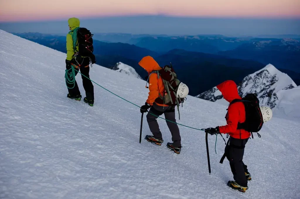
The hut ascent to the Gouter hut at 3,835 m offers easy climbing and the always tricky, rockfall-dangerous crossing of the Grand Couloir. Just below the summit of the Aiguille du Gouter sits the modern and architecturally successful mountaineering accommodation, which can be reached after an ascent of over 1,500 m from the Nid d'Aigle cable car station. From the Gouter hut, you set off early the next day in the direction of Mont Blanc. For these last 1,000 m of ascent, you need to be in good physical condition and well adapted to the altitude. If you have both, then the walk over the narrow Bosses ridge to the highest peak in the Alps is pure pleasure. Depending on the wind and weather, the best and most extensive Alpine panorama awaits you there, but from an unusual perspective: the Matterhorn, Monte Rosa, Gran Paradiso and all the other peaks are significantly lower and line up unspectacularly in the sea of peaks that stretches to the horizon. Private huts or Alpine Club huts with limited comfort (e.g. Rif. Cosmiques, Rif. Chabod, Rif. Torino or similar) await you as bases for this high-altitude tour
Program and schedule
- State certified mountain guide:in
- 1 x reserve day for bad weather on Mont Blanc
- 1 x mountain guide for max. 2 participants
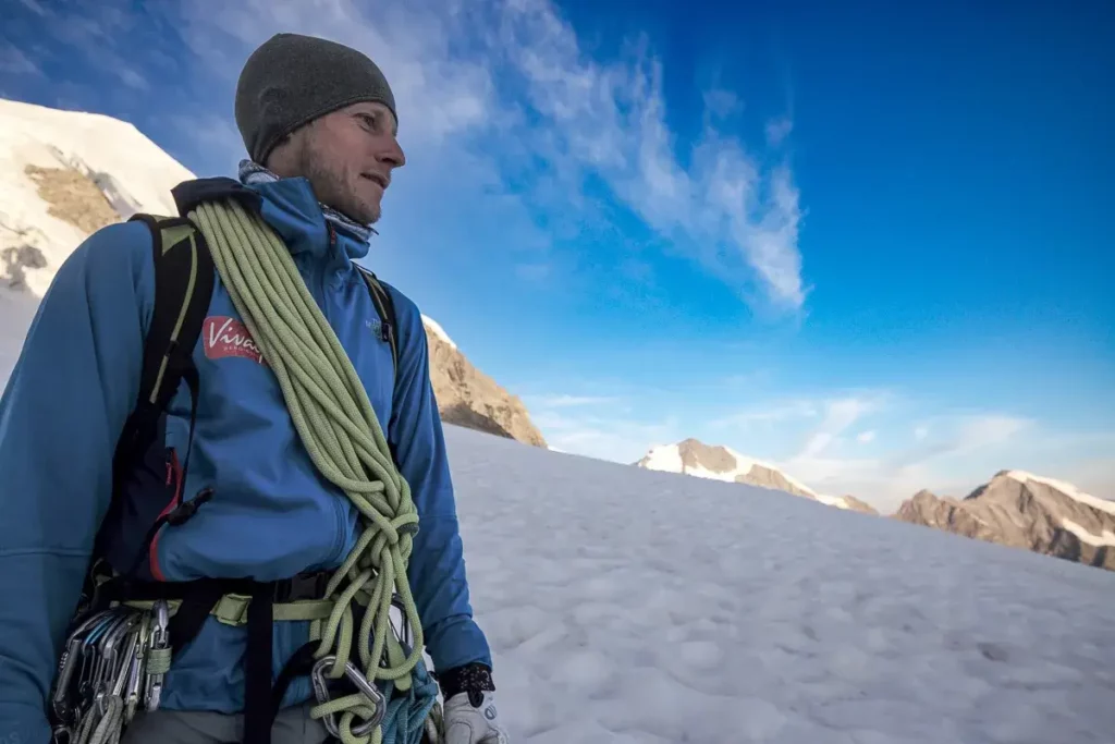
- Edelrid mountaineering equipment with crampons, ice axe, helmet, climbing harness
- Online training (1 h)
Additional costs
- Overnight stay with half board (paid on site)
- Costs mountain railroads
- Snacks, drinks
- Arrival
Preparation: We recommend independent acclimatization tours on the weekends or directly before the tour for preparation!
Day 1Meeting point at 09:00 in Staffal, on the Italian side of Monte Rosa. Ascent by cable car to "Punta Indren", hike through snow, ice and rock to the Gnifetti hut (3,647 m). Ideal altitude for acclimatization, short glacier training in the afternoon, overnight stay at the Gnifetti hut.
2nd day: Summit ascent of the Vincent Pyramid (4,215 m) and the Balmenhorn (4,167 m), which is virtually "taken along" on the descent. Start at almost 3,700 m, easy day and perfect altitude adjustment, overnight stay again at the Gnifetti hut.
Day 3: Hike back to Punta Indren, descent by cable car to Staffal, drive to Chamonix, overnight in hotel.
Day 4: Meeting in Chamonix, tour briefing and equipment check, ascent with the Bellevue cable car and the cog railroad to the Eagle's Nest and on to the Tète-Rousse hut (3,167 m) in approx. 3 hours.
Day 5: Crossing of the "Grand Couloir", arrival at the Goûter hut after approx. 2 hours, then ascent to the summit of Mont Blanc, overnight stay at the Goûter hut
Day 6: Descent and crossing of the couloir, around noon arrival in Chamonix, journey home.
Note on program changes:
All courses and guided tours are conscientiously organized and carried out in accordance with the safety standards of the Vivalpin Mountain and Ski School with qualified specialists (e.g. mountain and ski guides, mountain hiking guides, etc.). The provisional tour program may be adjusted for safety-related reasons, such as bad weather, dangerous conditions, unforeseen natural events or inadequate conditions of the participants. The final program will be decided by the guide on site.
- Up to 1,800 m ascent and 2,400 m descent
- Stamina for up to 8 h ascent
- Surefootedness and head for heights
- Mountain experience, experience of alpine glacier and high altitude tours, in crampon walking or ice course
.


Similar tours

Online training: Risk management ice cream

When you are in the high mountains, there is a lot to consider. You should be familiar with objective and subjective dangers, know your equipment and be able to correctly assess the difficulties and requirements. You will learn everything you need to know about weather and orientation, about physical relationships and, of course, also about the right route from an experienced mountain professional....

Iceclimbing Camp with Simon Gietl

Simon Gielt invites you. To the place where he learned and trained in ice and mixed climbing. Simon knows the most difficult ice routes in the Dolomites and the Alps, he has a huge wealth of experience in steep ice, but he is also a gifted mountain guide and coach (see also Climbing with the Rockstar or Icy Times on our blog). The...
Private mountain guide:in
Want a dream tour? We will be happy to organize an optimally qualified guide for you and your friends, family or company. Over 80 mountain guides are looking forward to your dream tour with you. They have turned their hobby into a profession and will accompany you with great commitment after meticulous preparation. There are virtually no limits: From...

Ötztal Alps Crossing

The Ötztal Alps are a high-altitude touring region in a class of its own. The most beautiful and highest three-thousand-meter peaks of the Ötztal can be perfectly combined on technically relatively easy ascents during this touring week. The absolute highlight is the ascent of the highest Tyrolean peak, the 3,774m high Wildspitze.

Four-thousand-metre peaks in the Valais (spaghetti round)

The "Spaghettirunde" with up to 10 four-thousand-meter peaks is one of the most beautiful and popular ridge and four-thousand-meter tours in the Alps. The climbs are technically considered relatively easy, but you should still bring high altitude touring experience and especially a very good condition for up to 10h mountaineering.

The lightest 4000
Breithorn (4,165m), Strahlhorn (4,190m), Allalinhorn (4,027m), Bishorn (4,153m) and Alphubel (4,206m) are considered technically easy four-thousanders. Nevertheless, the normal routes are anything but boring "glacier hikers". The panorama from the individual peaks is simply phenomenal and a fair reward for the efforts.

Wildspitze (3.774 m) high tour course
Learning by doing is the motto of the high altitude course with summit ascent Wildspitze (3.774m). Your professional guide will train you intensively for independent high altitude tours and summit ascents. With high-quality EDELRID test equipment!

Fit on the glacier and on high altitude tours
The goal of the high altitude course is the independent execution of easy high altitude tours with glacier climbing. You will learn and improve specific belaying techniques as well as the necessary crampon and climbing techniques.

Großglockner (3.798 m) high tour course
The Großglockner, the highest peak in Austria, offers everything that makes a real high altitude tour. Before the ascent to the summit, your mountain and ski guide will train with you the basics for easy and medium-difficulty high-altitude tours.